Professional Land Surveying Services: Navigating Your Australian Property Journey
Owning property in Australia is a significant investment and a source of immense pride. Whether you're a homeowner looking to extend, a developer planning a new estate, or a business embarking on a major infrastructure project, the ground beneath your feet holds the key to success. But how do you truly understand what's there, where your boundaries lie, or what's permissible for development? This is where professional land surveying services become not just useful, but absolutely essential.
In a country as vast and diverse as Australia, with its unique landscapes and varied state regulations, the expertise of a licensed land surveyor is invaluable. From the bustling metropolises of Sydney and Melbourne to the vibrant communities of Brisbane, Adelaide, and Perth, and down to the charming capital of Hobart, understanding your land is the foundational step for any property venture. Without precise, authoritative data, you risk costly disputes, project delays, and even legal complications.
At Get 3 Quote, we understand the critical need for reliable, expert professionals. We connect you with trusted local service providers for all your surveying needs, ensuring your project starts on solid ground. This comprehensive guide will demystify professional land surveying services, highlighting why they are crucial for every Australian property owner and developer.
What Exactly Are Professional Land Surveying Services?
At its core, land surveying is the science of accurately determining the terrestrial or three-dimensional position of points and the distances and angles between them. However, professional land surveying services extend far beyond mere measurement. It's a blend of art, science, and legal interpretation, performed by highly skilled and licensed surveyors who understand the intricate interplay of land, law, and development.
Think of it as the blueprint for everything that happens on or under a piece of land. A surveyor’s work provides the fundamental data required for:
- Defining legal boundaries: Crucial for property transactions, fencing, and resolving disputes.
- Planning and design: Providing detailed topographical information for architects and engineers.
- Construction: Ensuring structures are built precisely where they are intended.
- Resource management: Mapping natural features and resources.
- Legal documentation: Creating plans that are legally binding and registered with government bodies.
In Australia, licensed surveyors adhere to strict professional standards and are regulated by their respective state boards, ensuring the highest level of accuracy and integrity in their work. Their expertise is paramount for any land development or construction project, providing peace of mind and protecting your investment.
Why You Absolutely Need a Land Surveyor in Australia (Especially in Our Major Cities)

Australia’s diverse geography and state-specific regulations make the role of a local land surveyor indispensable. From the expansive suburban growth in Melbourne to the high-density developments in Sydney, the unique challenges of Perth’s sandy soils, Brisbane’s flood plains, Adelaide’s heritage zones, and Hobart’s hilly terrain, each region presents distinct considerations for property owners and developers.
For Residential Homeowners: Securing Your Sanctuary
Even for a seemingly simple residential property, professional land surveying services can save you from future headaches. Consider these scenarios:
- Fencing Disputes: A common neighbourly issue, easily resolved with an accurate boundary survey. Knowing exactly where your property ends and your neighbour's begins is critical before erecting a fence.
- Extensions and Renovations: Planning to add a deck, pool, or extension? You need to ensure it complies with setback regulations and doesn't encroach on easements or neighbouring properties. A detailed site survey is your first step.
- Buying or Selling Property: An identification survey can uncover issues like encroachments, unregistered easements, or discrepancies in existing plans, protecting both buyer and seller.
- Building Near Boundaries: Many councils have strict rules about building close to property lines. A surveyor ensures compliance, preventing costly rework or legal battles.
- Dilapidation Services: If significant construction is happening next door, a dilapidation report documents the existing condition of your property, providing crucial evidence should any damage occur during the neighbouring project.
For homeowners across Sydney, Melbourne, Brisbane, Adelaide, Perth, and Hobart, securing your home often starts with a clear understanding of its physical and legal context, provided by expert property services.
For Property Developers & Builders: Laying the Groundwork for Success
For those involved in land development and construction, professional land surveying services are the backbone of every successful project. They provide the precision needed from concept to completion:
- Land Division & Subdivision: This is a core service. Whether you're creating a few new lots or a large master-planned community, land division and land subdivision require meticulous planning and accurate surveys to ensure compliance with council regulations and create marketable titles. This is particularly vital in rapidly growing areas like Melbourne's outer suburbs or Brisbane's expanding corridors, as well as for regional development across South Australia and other states.
- Feasibility Studies: Before investing heavily, a topographic survey can reveal the true lay of the land, identifying challenges like steep slopes, flood zones, or significant rock formations that impact design and cost.
- Construction Set-Outs: Translating architectural and engineering designs onto the ground, ensuring buildings, roads, and utilities are constructed in their precise locations. This is vital for all construction projects, from residential to large-scale commercial and civil works.
- Engineering Surveys: Providing critical data for infrastructure design, including roads, bridges, and drainage systems.
- Project Management Support: Surveyors often work closely with project managers, providing ongoing data and advice to keep projects on track and within budget. Their input is crucial for effective project management.
From the first sod turned in a new Perth estate to the intricate planning of a high-rise in Sydney, land development surveying is the unsung hero.
For Commercial & Government Projects: Precision on a Grand Scale
Large-scale commercial and government civil projects, such as new infrastructure, mining operations, or major public works, demand the highest level of surveying precision and a wide range of services:
- Infrastructure Development: Roads, railways (rail services), bridges, and utilities all rely on accurate survey data for design, construction, and ongoing maintenance.
- Mining Surveys: Essential for exploration, mine planning, volume calculations, and safety monitoring in Australia's vast mining regions.
- Hydrographic Surveys: Mapping underwater terrain for maritime navigation, port development, and environmental studies, crucial for coastal cities like Sydney, Melbourne, Perth, and Brisbane.
- Underground Service Locating & Utility Mapping: Before any excavation, identifying and mapping existing underground services (water, gas, electricity, communications) is critical for safety and preventing costly damage. This underground service locating and utility mapping protects vital infrastructure.
- Monitoring Surveys: Tracking ground movement or structural integrity over time, especially for large structures or unstable ground.
The complexity and scale of these projects necessitate the most advanced surveying techniques and experienced teams, often provided by leading surveying company firms like Pyper Leaker (as referenced in the keyword data) or State Surveys, which offer comprehensive solutions across Australia.
Key Services Offered by Professional Land Surveyors
Modern professional land surveying services offer a comprehensive suite of solutions tailored to various needs. Here's a breakdown of the most common and vital services you might require:
- Boundary Surveys: This fundamental service accurately determines the legal boundaries of a property, marking them with pegs or other monuments. Essential for buying/selling, fencing, and resolving disputes.
- Land Division & Land Subdivision: The process of dividing a single parcel of land into two or more smaller lots, or consolidating multiple lots into one. This involves complex planning, council approvals, and precise surveying to create new titles. It's a cornerstone of land development, particularly in areas like Adelaide land development and land subdivisions Adelaide.
- Feature & Topographic Surveys: Mapping the natural and artificial features of a site, including contours (elevation changes), trees, buildings, roads, and drainage. This data is critical for design and planning.
- Construction Set-Outs: Translating architectural and engineering plans onto the ground, guiding the precise placement of foundations, walls, columns, and utilities during construction.
- Identification Surveys: A survey conducted to identify the position of buildings and other improvements relative to the property boundaries. Often required for property transactions.
- Lease Surveys: For commercial properties, these surveys define the leasable area within a building or complex, often required for legal agreements.
- Laser Scanning & 3D Modelling: Using advanced laser scanning technology to capture millions of data points, creating highly detailed 3D models of existing conditions. Ideal for complex structures, heritage buildings, or large industrial sites.
- Dilapidation Reports: Documenting the existing condition of a property prior to nearby construction, serving as a baseline to assess any damage that may occur during the works. These are crucial dilapidation services.
- Underground Service Locating: Identifying and mapping the location of buried utilities like water pipes, gas lines, electrical cables, and communication lines before excavation, preventing accidents and damage. This is a vital service locating function.
- Utility Mapping: Comprehensive mapping of all existing above-ground and underground utilities, providing a full picture of the infrastructure on a site.
- Easement Surveys: Defining the rights of others to use a portion of your land, such as for utility access or shared driveways.
- Volume Surveys: Calculating the volume of earthworks, stockpiles, or excavations, important for budgeting and progress monitoring on construction sites.
This wide range of services ensures that whatever your project, a professional land surveyor has the solutions to provide the accurate data you need.
Choosing the Right Professional Land Surveying Service: What to Look For
With so much at stake, selecting the right land surveyor is paramount. Here’s what to consider when looking for professional land surveying services in cities like Sydney, Melbourne, Perth, Brisbane, Adelaide, or Hobart:
Licensing and Qualifications: The Non-Negotiable
Always ensure your surveyor is officially licensed in your state or territory. This guarantees they meet rigorous educational, experience, and ethical standards. Look for firms with a strong track record and years of experience, such as those that have been serving clients in South Australia for decades, like Hennig & Co or Mosel Surveyors. A licensed surveyor provides the necessary legal weight and accuracy to their work.
Local Knowledge: Understanding the Lay of the Land (and the Law)
Regulations, planning schemes, and even geological conditions can vary significantly from one council area to another, and certainly between states. A surveyor with strong local knowledge – whether they are surveyors Adelaide, a firm in Sydney, or a team in Perth – will be familiar with:
- Specific council requirements for land division or development applications.
- Local environmental overlays or heritage considerations.
- Common boundary issues or historical survey points in the area.
- The unique challenges of regional South Australia or specific metropolitan areas.
This local insight can save you considerable time and money.
Technology and Innovation: Precision for the Future
The field of surveying is constantly evolving. Reputable firms invest in cutting-edge technology such as GPS, robotic total stations, drones for aerial mapping, and laser scanning equipment. These tools enhance accuracy, efficiency, and the ability to capture complex data, leading to better outcomes for your project. Ask about their technological capabilities, especially for complex engineering surveys or large-scale mapping tasks.
Reputation and Reviews: Trustworthiness Matters
Seek out firms with positive client testimonials and a strong reputation for reliability and professionalism. Online reviews and word-of-mouth recommendations can offer valuable insights into a company’s service quality and client satisfaction. Look for teams known for their integrity and commitment to delivering accurate results.
Clear Communication & Transparency: Your Project, Your Understanding
A good surveyor will communicate clearly, explain the process in an understandable way, and provide transparent quotes. They should be accessible for questions and keep you informed throughout the surveying project. Before committing, ask for a detailed quote that outlines the scope of work, timeline, and all associated costs. Firms that provide a wide range of services should be able to clearly articulate how each service benefits your specific needs.
The Process: What Happens When You Engage a Land Surveyor?

While every surveying project is unique, there's a general process that most professional land surveying services follow:
- Initial Consultation & Quote: You make contact with the surveying firm (or use a platform like Get 3 Quote to find multiple options). You'll discuss your specific needs, the nature of your property (e.g., residential, commercial, land development), and what you hope to achieve. The surveyor will provide a detailed quote and outline the scope of work.
- Research & Planning: Before stepping onto your property, the surveyor will conduct extensive research. This involves reviewing existing title documents, historical survey plans (including any state surveys or previous land surveys), council regulations, and any relevant easements or restrictions. This initial planning phase is crucial for ensuring accuracy and legal compliance.
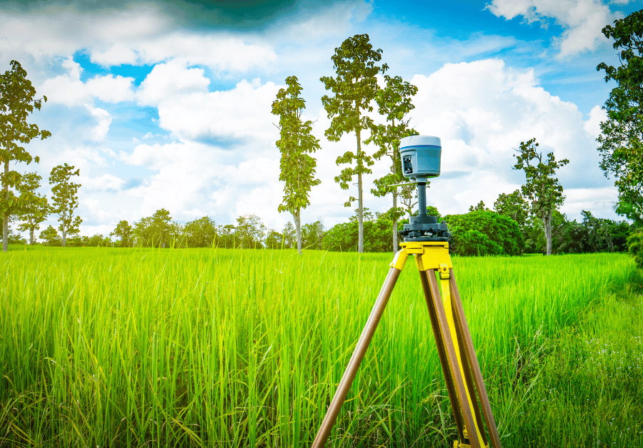
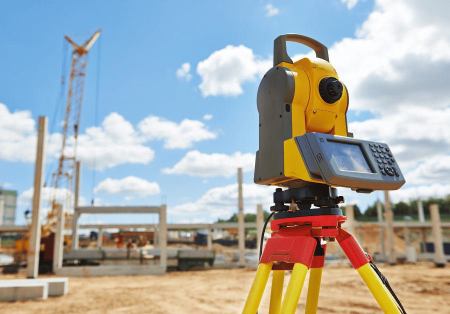
- Fieldwork & Data Collection: This is where the physical surveying takes place. Using advanced equipment, the surveyor's team will visit your site to collect precise measurements. This might involve setting up survey points, using GPS, total stations, or even drones for aerial mapping. For underground service locating, specialised equipment is used to detect buried utilities.
- Data Processing & Analysis: Back in the office, the collected raw data is processed using sophisticated software. The surveyor analyses the measurements, cross-references them with existing records, and interprets them in the context of legal boundaries and planning regulations.
- Plan Generation & Reporting: Based on the analysis, detailed plans, diagrams, and reports are prepared. These documents are precise, legally compliant, and often registered with the relevant land titles office or local council. Examples include boundary survey plans, subdivision plans, or topographic maps.
- Certification & Delivery: The final plans are certified by the licensed surveyor, confirming their accuracy and compliance. These documents are then provided to you, ready for submission to councils, legal firms, or for your own records. For complex land development surveying regional projects, there might be ongoing consultation and adjustments.
This systematic approach ensures that every surveying project is executed with the highest level of precision and professionalism, providing you with reliable and legally sound information.
Why Get 3 Quote is Your Go-To for Professional Land Surveying Services
Finding the right professional land surveying services can feel daunting. You need a trusted expert who understands your local context, whether that's the complex planning laws of Sydney, the rapid growth in Melbourne, the specific geological considerations in Perth, the flood zone mapping in Brisbane, the heritage considerations in Adelaide, or the unique topography of Hobart. That's where Get 3 Quote steps in.
Our mission is to simplify the process of connecting homeowners and businesses with reliable, verified local service providers across Australia. Here's how we make it easy for you to find the perfect land surveyor:
- Tell Us What You Need: Fill out our simple online form and describe your surveying requirements. Whether it's a boundary survey, a land division, or a large-scale land development project, be as specific as possible.
- Get Quotes from Professionals: We'll connect you with up to 3 detailed quotes from verified, licensed surveyors in your area. Our network includes highly experienced professionals offering a wide range of services, from residential to commercial and engineering surveys.
- Choose the Best Match: Compare quotes, review profiles, and read testimonials from other clients. You'll have all the information you need to choose the perfect professional for your job, ensuring you get quality service at a competitive price.
We take the guesswork out of finding reliable professional land surveying services, empowering you to make informed decisions for your property or project. Our platform is designed to save you time and provide peace of mind, knowing you're connecting with vetted experts.
Look for a licensed surveyor with local knowledge, strong client reviews, and modern equipment like GPS, drones, and laser scanners. Ensure they’re familiar with your council’s regulations and provide a clear, detailed quote before starting.
Costs vary based on property size, location, complexity, and the type of survey required. A small residential boundary survey may cost a few hundred dollars, while large-scale commercial or subdivision projects can run into thousands. Comparing multiple quotes is the best way to get value.
Start Your Project on Solid Ground Today!
Don't leave the crucial details of your property or development project to chance. The accuracy and legal compliance provided by professional land surveying services are indispensable for avoiding future complications and ensuring success.
Whether you're in Sydney, Melbourne, Perth, Brisbane, Adelaide, or Hobart, Get 3 Quote is your trusted partner in finding the right licensed surveyors for your needs. Take the first step towards clarity and confidence in your property ventures.
Ready to find the perfect land surveyor for your project? Don't leave your property's future to chance. Visit Get 3 Quote today to connect with trusted local professionals and get up to 3 competitive quotes!